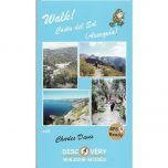
Costa del Sol (Axarquia) Tour and Trail Walking Map
£10.99
In stock
SKU
10-SPA-402
This map covers the Axarquia part of the Costa del Sol to the east of Malaga. The map covers an area from Ventas de Zafarraya in the northwest to Almunecar in the southeast, plus the coastal towns of Nerja, Torrox Costa, Lagos and El Morche. The map is printed on both sides (east and west areas) with a generous overlap.
The map shows a great network of walking and hiking trails at a scale of 1:40,000. The map including GR (Gran Recorido) official routes, local hiking routes, and shows part of the Sierras of Tejeda, Almijara and Almara Natural Park. The Sierras of Tejeda, Almijara and Almara Natural Park is a rugged mountainous region famous for its attractive villages, and is a superb hiking area.
Published by Discovery Walking Guides in May 2017 this Costa del Sol (Axarquia) walking map is printed on both sides. The “Super-Durable” nature of this map means it is water resistant, and as the name suggests, very durable.
Map Scale is 1:40,000
Map sheet size is 840mm x 700mm
Folded size is 240mm x 120mm
ISBN is 9781782750390

| ISBN is: | 9781782750390 |
|---|---|
| Free 2nd class UK postage | Yes |
| Scale Is: | 1:40,000 |
Write Your Own Review
We found other products you might like!