Walking the Yorkshire Wolds Way National Trail Path
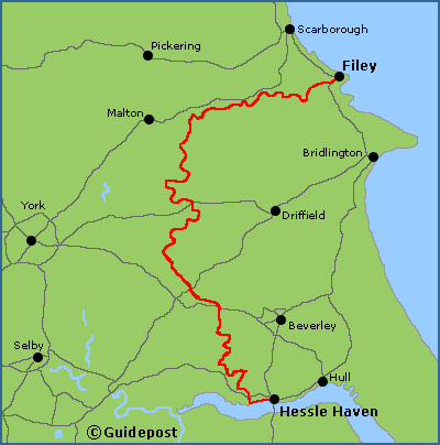
The Yorkshire Wolds Way National Trail long distance path starts at Hessle Haven on the banks of the Humber, and heads north before finishing at the seaside resort of Filey on the North Sea coast. In between there is an amazing chalk landscape, wooded valleys, and gentle rolling hills, alongside vibrant market towns and ancient villages.
Map of the Yorkshire Wolds Way National Trail long distance path

What maps and guidebooks are available for the Yorkshire Wolds Way National Trail Path?
There are numerous maps and guidebooks that cover the Yorkshire Wolds Way National Trail Path that are available to buy from our shop. These include the Yorkshire Wolds Way XT40 map that is produced by Harvey Maps, and the official guidebook published by Aurum Press that is called the Yorkshire Wolds Way by Tony Gowers.
Buy walking maps and guidebooks for the Yorkshire Wolds Way National Trail Path from our shop.
Buy walking maps and guidebooks for the Yorkshire Wolds Way National Trail Path from our shop.


