Walking the South West Coast National Trail long distance path
The South West Coast National Trail long distance path starts at Minehead in Somerset and hugs the coast all the way around Devon and Cornwall before finishing at Studland, near Poole in Dorset. The route has its origins as a coastguard patrol route to restrict smuggling, and is packed with dramatic scenery and cliffs.
Map of the South West Coast National Trail long distance path

What maps and guidebooks are available for the South West Coast National Trail Path?
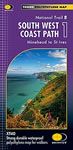
There are 3 maps available covering the whole of the South West Coast National Trail Path that have been published by Harvey Maps that are available from our shop.
There are 4 official guidebooks for the South West Coast National Trail is published by Aurum Press. The first guidebook covers the South West Coast route from Minehead to Padstow. The second guidebook covers the South West Coast route from Padstow to Falmouth. The third guidebook covers the South West Coast route from Falmouth to Exmouth. The fourth guidebook covers the South West Coast route from Exmouth to Poole.
Buy walking maps and guidebooks for the South West Coast National Trail Path from our shop.

Buy walking maps and guidebooks for the South West Coast National Trail Path from our shop.