Buy the Mount Pelion and Mount Mavrovouni walking map from our shop.
Walking on the Pelion Peninsula
The mountainous Pelion (Pilio) peninsula is located in central Greece, near Volos, forming a hook-like peninsula between the Pagasetic Gulf and the Aegean Sea. Mount Pelion’s highest summit is called Pourianos Stavros that is 1,624m high. Further north is another major peak called Mount Mavrovouni near Lake Karla.
The Pelion peninsula is an excellent place for a walking and hiking holiday with an abundant number of hiking trails and paths. This network of paths includes forest paths, goat tracks, and stone-built donkey paths, called Kalderimi, with beautiful arched stone bridges that link plenty of traditional villages. These traditional villages contain farms, monasteries, old buildings, springs and country churches that overlook the sea.
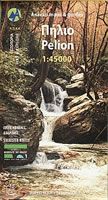
The Mt Pelion and Mt Mavrovouni walking map highlights twenty proposed hiking routes along with all the hiking and walking paths throughout the region at a scale of 1:45,000. Buy this Mt Pelion walking map from our shop.
Map of the Pelion Peninsula including Mount Pelion

Buy the Mount Pelion and Mount Mavrovouni walking map from our shop.