The Paklenica National Park Map covers all the walking and hiking paths and trails in Paklenica at a scale of 1:25,000.
Buy this Paklenica National Park map from our shop.
Walking in Paklenica National Park in the Velebit Mountains
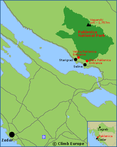
Paklenica National Park is a hiker’s paradise, combining craggy limestone gorges, caves, dense pine forest and meadow-carpeted alpine uplands. The Park essentially consists of 2 gorges that lead up to a high plateau in the southern Velebit Mountains. These 2 gorges are called Velika (Big) Paklenica and Mala (Small) Paklenica as shown on the map opposite.
The entrance to Velika (Big) Paklenica is accessed from the coastal village of Starigrad and it is the main entrance to the National Park. Hiking is the best way to explore Paklenica National Park (cars are forbidden) as there are nearly 200km of paths and trails throughout the park that are well sign posted. From the Velika Paklenica entrance there a number of circular day walks, including those leading to the Manita peć cave and the Lugarnica forest cottage. The scenery here is stunning as these trails snake through the narrow gorge passing beneath the rock face of Anica kuk that is popular with rock climbers. The gorge then opens out with different paths and trails going in all directions into forests and higher into the mountains.
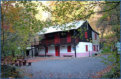
A popular trail leads to the Planinarski Dom mountain hut that takes around 2-hours. This hut has around 50 beds, a kitchen and dining room. It is open every day from June to September, and at weekends during the rest of the year. This hut is a popular base to explore the higher Velebit Mountains including the highest peak, which is Vaganski Vrh at 1,757m high.
Map showing the location of Paklenica National Park near Zadar

The entrance to Mala (Small) Paklenica is accessed from the coastal village of Seline, 5km south of Starigrad. Mala Paklenica has deliberately been left undeveloped in order to protect its status as a (relatively) untouched wilderness. Paths and trails are not maintained or marked as they are in Velika Paklenica, and you’ll need a good map to explore it, such as the Paklenica National Park Map that is available to buy from our shop.
Paklenica National Park Walking Logistics
The nearest city is Zadar, which is approximately 50km from Paklenica, where there is an International Airport. Both Starigrad and Seline have plenty of accommodations options, from bed and breakfast Pansions to villas, apartments, and campsites.
The Walks and Treks in Croatia guidebook covers 27 varied walks across Croatia including Paklenica, and is available to buy from our shop.

The above photograph shows the Planinarski Dom mountain hut, Paklenica National Park
he Paklenica National Park Map covers all the walking and hiking paths and trails in Paklenica at a scale of 1:25,000.
Buy this Paklenica National Park map from our shop.


