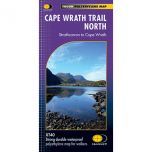
Cape Wrath Trail South XT40 Harvey Map
£17.50
In stock
SKU
02-NTM-029
This is a complete map of Southern half of the Cape Wrath Trail long distance path that is shown on 1 sheet. The map covers the section from Fort William to Strathcarron.
The Cape Wrath trail is approximately 200 miles long, which starts at Fort William and finishes at the Cape Wrath lighthouse on the most Southwest tip of mainland Britain. The trail has no official route with various options available of which are all shown on the map. The Cape Wrath trail passes through some of Scotland’s wildest and most spectacular scenery that attracts hikers from all over the World. This trail is recommended for very experienced long-distance backpackers as some sections of the route will require an overnight stop in the mountains, such as wild camping or the use of a bothy. The bothies are also shown on the map.
Published in June 2014 by Harvey Maps, it is printed on light, waterproof and tear-resistant synthetic paper. The map key and legend is in English, French and German text.
Map Scale is 1:40,000 and GPS compatible.
Folded size is 115mm x 240mm.

| ISBN is: | 9781751375349 |
|---|---|
| Free 2nd class UK postage | Yes |
| Scale Is: | 1:40,000 |
Write Your Own Review
We found other products you might like!