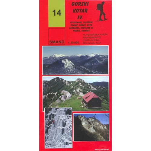
Gorski Kotar IV Map - Risnjak National Park
£9.95
In stock
SKU
10-CRO-014
This walking map covers part of the Gorski Kotar mountain range (map 4 of 4) and includes the walking paths and trails in the Risnjak National Park near Delnice.
The map includes the following mountain peaks:
Veliki Risnjak 1528m , Snježnik 1505m, Obruč 1376m, V. Drgomalj 1154m, Petehovac, Štimčev vrh 1024m, Praprot 929m, Pintarica 800m, Lazačka glavica 1426m, Planina 1425m, Jelenc 1442m, Gornji Medvejci 1461m, and Guslica 149m
Published in 2014 by SMAND (map number 14) the map legend/key is in Croatian, German, Italian, and English text.
Map Scale is 1:30,000
Map sheet size is 680mm x 970mm
Folded size is 115mm x 232mm
ISBN is 9789539721747
| ISBN is: | 9789539721747 |
|---|---|
| Free 2nd class UK postage | Yes |
| Scale Is: | 1:30,000 |
Write Your Own Review
We found other products you might like!
![Dinara Mountain Map [40]](https://climb-europe.com/pub/media/catalog/product/cache/dadd9a99528695eab1f8fe8a8f1ff559/d/i/dinara-mountains-map_1.jpg)
![Biokovo Mountain Nature Park Map [32]](https://climb-europe.com/pub/media/catalog/product/cache/dadd9a99528695eab1f8fe8a8f1ff559/b/i/biokovo-mountains-map-32-2017.jpg)
![Paklenica National Park Map [19]](https://climb-europe.com/pub/media/catalog/product/cache/dadd9a99528695eab1f8fe8a8f1ff559/p/a/paklenica-national-park-map.jpg)