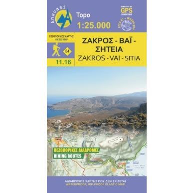
Zakros, Vai, and Sitia Walking Map
£8.95
In stock
SKU
10-GRE-11-16
This map shows all the waking paths and hiking trails on the eastern edge of Crete. It covers the area around Sitia and Vai in the north, Zakros in the centre, and onto Xerokampos and Goudouras in the south. The area has unique geological and natural wealth with caves, gorges and the palace of Zakros, one of the biggest Minoan palaces in Crete.
Most of the map is covered by a Geopark where 11 walking and cycling trails have been established that are detailed on the map. The start of the E4 Cretan Way long distance path starts at Zakros gorge that is also detailed on the map.
Published in 2015 by Anavasi and is map number 11.16. The text and legend of this map is in English and Greek throughout.
Map Scale is 1:25,000.
This Zakros, Vai, and Sitia map is laminated (waterproof and rip-proof) and is compatible with GPS systems.
| ISBN is: | 9789608195707 |
|---|---|
| Free 2nd class UK postage | Yes |
| Scale Is: | 1:25,000 |
Write Your Own Review
We found other products you might like!
![Frangokastelo and Plakias Walking Map [11.17]](https://climb-europe.com/pub/media/catalog/product/cache/dadd9a99528695eab1f8fe8a8f1ff559/c/r/crete-frangokastelo-and-plakias-walking-map-11-17.jpg)
![Mt Dikti and Mt Selena Walking Map [11.15] by Anavasi](https://climb-europe.com/pub/media/catalog/product/cache/dadd9a99528695eab1f8fe8a8f1ff559/c/r/crete-mt-dikti-and-mt-selena-walking-map-11-15-2022.jpg)
![Asterousia and Phaistos Walking Map [10.18]](https://climb-europe.com/pub/media/catalog/product/cache/dadd9a99528695eab1f8fe8a8f1ff559/c/r/crete-asterousia-and-phaistos-walking-map-10-18.jpg)
![Mt Ida (Psiloritis) Walking Map [11.14]](https://climb-europe.com/pub/media/catalog/product/cache/dadd9a99528695eab1f8fe8a8f1ff559/m/t/mt-ida-psiloritis-walking-map.jpg)