Walking the Pennine Way National Trail long distance path
The Pennine Way National Trail long distance path starts at Edale in the Peak District, and finishes at Kirk Yetholm in the Scottish Borders. The route essentially travels the mountain tops along the rugged backbone of England through the gritstone moors of the Peak District, the Yorkshire Dales and finally finishing in beautiful Northumberland.
Map of the Pennine Way National Trail

What maps and guidebooks are available for the Pennine Way National Trail Path?
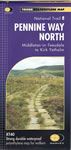
There are numerous maps and guidebooks that cover the Pennine Way National Trail Path that are available to buy from our shop. These include 2 maps produced by Harvey. The Pennine Way south XT40 map covers the routes from Edale to Middleton-in-Teesdale, and Pennine Way north XT40 map covers the route from Middleton-in-Teesdale to Kirk Yetholm. The office guidebook is published by Aurum Press and is called the Pennine Way by Damian Hall.
Buy walking maps and guidebooks for the Pennine Way National Trail Path from our shop.

Buy walking maps and guidebooks for the Pennine Way National Trail Path from our shop.