Walking the Cleveland Way National Trail
The Cleveland Way walking route starts at Helmsley taking you through the heather moorland of the North York Moors National Park, winding its way north to Saltburn on the coast. From here the route heads south along the stunning Yorkshire coastline to Filey passing through the coastal towns of Whitby and Scarborough.
Map of the Cleveland Way National Trail

What maps and guidebooks are available for the Cleveland Way National Trail Path?
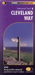
There are numerous maps and guidebooks that cover the Cleveland Way National Trail Path that are available to buy from our shop. These include the Cleveland Way XT40 map that is produced by Harvey Maps, and the official guidebook published by Aurum Press that is called the Cleveland Way by Ian Sampson.
Buy walking maps and guidebooks for the Cleveland Way National Trail Path from our shop.

Buy walking maps and guidebooks for the Cleveland Way National Trail Path from our shop.