
Walks and Treks in the High Mountains of Crete Guidebook
Buy walking guidebooks for Crete from our shop.
Walking and hiking in Crete
Crete is a great place for a walking holiday with high mountains close to the sea, numerous gorges, dramatic coastline and a large network of ancient paths and shepherds trails. Crete has a great history with many Minoan palaces, Byzantine churches and Venetian fortifications to visit, interspersed with attractive villages.
Map of the main walking and hiking areas in Crete

Mountains run across Crete with Mt Ida (also known as Mt Psiloritis) in the centre of the island being the highest point. Mt Ida actually consists of 5 summits, which are: Timios Stavros (Holy Cross) 2,456m: Agathias 2,424m: Stolistra 2,325m: Voulomenou: 2,267m: and Koussakas 2,209m.
The White Mountains are in the western part of Crete, and consist of over 30 summits that are over 2,000m high, with highest point being 2,453m (Pachnes). These White Mountains cover a large part of western Crete and are wild with very few roads in and out. There is very little vegetation and the white limestone rock and the snow that lasts until the spring give this region its name.
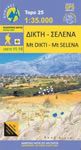
In the east of Crete are Mt Dikti and the Lassithi Plateau. The Lassithi Plateau is remarkably flat and wide at an altitude of 800 to 850m with Mt Dikti to the south and Mt Selena to the north. In the foot of the mountains are 18 villages that surround the plateau and are connected by a 23km circular road.
The Samaria Gorge is the longest gorge in Europe and is located in the White Mountains, in a dedicated National Park. A popular hiking trail through the Samaria Gorge goes from the Omalos plateau to Agia Roumeli on the Libyan Sea. It is 16km long and passes through a stretch called the Iron Gates, where the gorge is only 4m wide and the cliffs are 1,100m high.
Walking The E4 Cretan Way
Large sections of the Cretan Way are waymarked, but not the entire route. Therefore good maps and a guidebook are essential for anyone who is planning on walking the entire route or just sections of it. The main guidebook is called “The Cretan Way – E4”, and it splits the route into 28-days. Each section includes maps, route descriptions, GPS tracking, and accommodation information for the whole route. Buy the Cretan way Guidebook from our shop.
- White Mountains Walking Map [11.11 and 11.12]
- Samaria Gorge, Sougia, and Paliochora Walking Map [11.13]
- Mt Ida (Psiloritis) Walking Map [11.14]
- Mt Dikti and Mt Selena Walking Map [11.15]
- Zakros, Vai, and Sitia Walking Map [11.16] – the start of the Cretan way
- Frangokastelo and Plakias Walking Map [11.17] – eastern side of the White Mountains
- Asterousia and Phaistos Walking Map [11.18]
Walks and Treks in the High Mountains of Crete Guidebook
Buy walking guidebooks for Crete from our shop.